
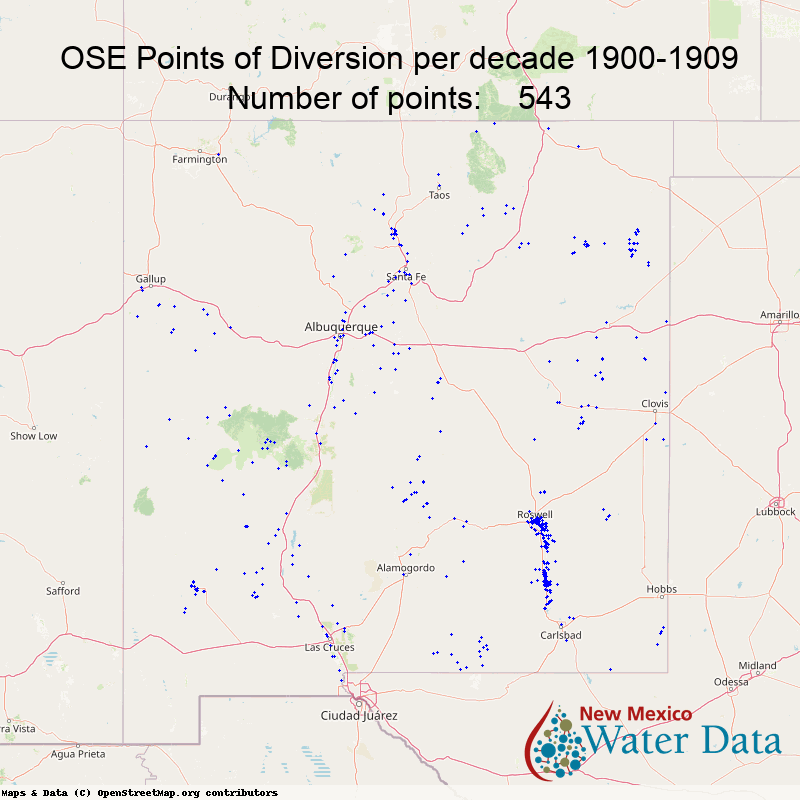
Permitted Points of Diversion since 1900
This animation shows the locations of Points of Diversion registered with the New Mexico Office of the State Engineer (OSE) from 1900-2022. This map shows groundwater wells, as points of diversion, with growth from 543 points of diversion declared in 1900-1910 to nearly 175,000 points in 2022. The increase follows the expanding population, agriculture, industry, and other water needs as the state has grown over the last 122 years.
These data are from the OSE W.A.T.E.R.S. (Water Administration Technical Engineering Resource System) database are available through the OSE’s Water Rights Reporting System (NMWRRS). To make this animation, the data were shared from the OSE as part of their engagement in the Water Data Act. The data were filtered to remove surface water points of diversion and do not include tribal or pueblo water rights. These decadal maps were then strung together to make a video (a “GIF”) that nicely shows the expanding water permitting in New Mexico.
For those technical readers: The maps used the library “py-staticmaps” (https://github.com/flopp/py-staticmaps). All of the maps are appended together and exported as a GIF using the python image library “Pillow” (https://python-pillow.org/). The python script used to generate the GIF is located at https://github.com/NMWDI/OSEPodsTools“. The development of this GIF was accomplished by Jake Ross, lead technical developer with the NM Water Data Initiative.
More background info on OSE WRRS data system is here:
