Project Overview

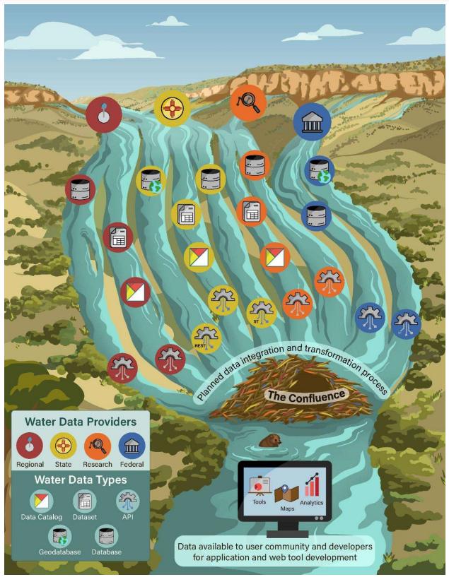
This braided stream visual depicts the combination of “water data streams” from multiple regional, state, research, and federal data providers. Each data provider can be considered an individual stream that is a tributary flowing toward a “confluence” of multiple data streams. The beaver dam depicts the WDI’s long-term goal of integrating data from different providers into usable, interoperable datasets.
Data providers with various internal data systems can store data in different ways, such as databases, geodatabases, or spreadsheets, which are shown as streams in this figure. Although each stream represents different methods of storing data internally, each can be shared via
APIs, which allow a computer to share data with other computers, servers, or programs. Data shared on the internet via an API can be used by developers to make dashboards or interactive maps. Spreadsheets can be posted to the WDI data catalog (powered by CKAN, an open-source platform), which can share data through an API. Databases and geodatabases can also be connected to APIs to share data.
Working to build and integrate these data sources is a current focus for the WDI. Integrated data will allow developers to use different data streams to create tools, maps, analytics, or dashboards, enabling data users to compare data from multiple providers. This will ultimately
save time and make accessing and using data more efficient and effective for decision-making.
WDI is currently developing a data integration engine, which aims to integrate multiple sources of groundwater data to produce a unified csv file. Users will be able to select different parts of the map to see which data sources are available for which organizations, and retrieve the data they need.
